|
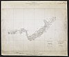
File:Map Attached to Protocol Describing Boundary between the Uganda Protectorate and German East Africa from Mt. Sabinio to Source of R. Chizinga. WOOS-17-2.jpg
From: https://commons.wikimedia.org/wiki/File:Map_Attached_to_Protocol_Describin... Uploaded by Ndalyrose. (In 1 mosaic) Last modified about 8 years ago. Unrectified. Links: |
 WMS Capabilities URL
 Tiles base URL
 Download points as CSV
Mosaic List for Map 719
| Mosaic | Title | Number of Maps | Percent Complete |
|---|---|---|---|

|
Category:War Office Archive – British East Africa
Compiled by tim. Last modified 2 months ago. Depicts : Links: |
570 maps |
9% (50 maps) |
Displaying 1 Layer per page.