Browse Maps
| Map | Title | Last modified | Status  |
|---|---|---|---|

|
From: https://commons.wikimedia.org/wiki/File:Map_of_Montgomery_County,_Pennsylv...
Links:
|
over 4 years ago. | 4 control points. |

|
From: https://commons.wikimedia.org/wiki/File:Colony_%26_Protectorate_of_Kenya._... (In 1 mosaic)
Links:
|
about 4 years ago. | 4 control points. |

|
From: https://commons.wikimedia.org/wiki/File:Lageplan_B%C3%BCrgenstockbahn_1888...
Links:
|
over 4 years ago. | 3 control points. |
|
From: https://commons.wikimedia.org/wiki/File:Neumann_map.jpg
Links:
|
about 4 years ago. | 3 control points. |

|
From: https://commons.wikimedia.org/wiki/File:Kolar_plan_1859.jpg
Links:
|
about 5 years ago. | 4 control points. |

|
From: https://commons.wikimedia.org/wiki/File:PPN611215985_Illustrirter_Plan_von...
Links:
|
about 5 years ago. | 4 control points. |

|
From: https://commons.wikimedia.org/wiki/File:PPN610755056_Wandkarte_des_Hamburg...
Links:
|
about 5 years ago. | 4 control points. |
|
From: https://commons.wikimedia.org/wiki/File:Plan_de_situation_forces_motrices_...
Links:
|
about 5 years ago. | 3 control points. |
|
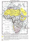
From: https://commons.wikimedia.org/wiki/File:Colonizable_Africa_1912.jpg
Links:
|
almost 4 years ago. | 16 control points. |
|
Links:
|
about 8 years ago. | 15 control points. |
Displaying Map 1281 - 1290 of 4750 in total. per page.