Browse Maps
| Map | Title | Last modified  |
Status |
|---|---|---|---|

|
From: https://commons.wikimedia.org/wiki/File:Plan_of_the_Athenian_Acropolis.jpg
Links:
|
about 6 years ago. | 4 control points. |

|
From: https://commons.wikimedia.org/wiki/File:Stationsplan_des_Botanischen_Garte...
Links:
|
about 6 years ago. | 3 control points. |

|
From: https://commons.wikimedia.org/wiki/File:Karte_von_Berlin_und_Umgebung_1913...
Links:
|
about 6 years ago. | 3 control points. |

|
From: https://commons.wikimedia.org/wiki/File:Provinz_Brandenburg_1905.png
Links:
|
about 6 years ago. | 3 control points. |

|
From: https://commons.wikimedia.org/wiki/File:Karte_der_Provinz_Brandenburg_Broc...
Links:
|
about 6 years ago. | 3 control points. |
|
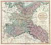
From: https://commons.wikimedia.org/wiki/File:1801_Cary_Map_of_Upper_Saxony,_Ger...
Links:
|
about 6 years ago. | 3 control points. |

|
From: https://commons.wikimedia.org/wiki/File:1909_Botanischer_Garten_Plan.jpg
Links:
|
about 6 years ago. | 4 control points. |

|
From: https://commons.wikimedia.org/wiki/File:Geometrischer_plan_des_Koenigliche...
Links:
|
about 6 years ago. | 4 control points. |

|
From: https://commons.wikimedia.org/wiki/File:Plan_Tiergarten_Berlin,_1793.jpg
Links:
|
about 6 years ago. | 4 control points. |
|
From: https://commons.wikimedia.org/wiki/File:Machu_Picchu_LB01.JPG
Links:
|
about 6 years ago. | 3 control points. |
Displaying Map 1671 - 1680 of 5917 in total. per page.