Browse Maps
| Map | Title | Last modified  |
Status |
|---|---|---|---|

|
From: https://commons.wikimedia.org/wiki/File:2024_Assassination_Attempt_of_Dona...
Links:
|
about 2 years ago. | Unrectified. |
|
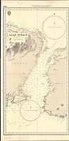
From: https://commons.wikimedia.org/wiki/File:Alas_Strait_Cropped_from_Admiralty...
Links:
|
about 2 years ago. | 4 control points. |

|
From: https://commons.wikimedia.org/wiki/File:Southern_India_Tallis.png
Links:
|
about 2 years ago. | 4 control points. |

|
From: https://commons.wikimedia.org/wiki/File:Paris-atlas_by_Fernand_Bournon_-_3...
Links:
|
about 2 years ago. | 3 control points. |

|
From: https://commons.wikimedia.org/wiki/File:Admiralty_Chart_No_682_Gulf_of_Kal...
Links:
|
about 2 years ago. | 5 control points. |

|
From: https://commons.wikimedia.org/wiki/File:Admiralty_Chart_No_2827_Puerto_Gib...
Links:
|
about 2 years ago. | 3 control points. |

|
From: https://commons.wikimedia.org/wiki/File:Admiralty_Chart_No_33_Kiel_Fiord,_...
Links:
|
about 2 years ago. | 4 control points. |

|
From: https://commons.wikimedia.org/wiki/File:Admiralty_Chart_No_19_Santos_Harbo...
Links:
|
about 2 years ago. | 4 control points. |

|
From: https://commons.wikimedia.org/wiki/File:Admiralty_Chart_No_3816_Verde_Isla...
Links:
|
about 2 years ago. | 6 control points. |

|
From: https://commons.wikimedia.org/wiki/File:Old_cadastral_map_of_Praha-Josefov...
Links:
|
about 2 years ago. | 5 control points. |
Displaying Map 2891 - 2900 of 8836 in total. per page.