Browse Maps
| Map | Title | Last modified  |
Status |
|---|---|---|---|

|
From: https://commons.wikimedia.org/wiki/File:AmCyc_Park_-_Map_of_Victoria_Park....
Links:
|
about 8 years ago. | 7 control points. |

|
From: https://commons.wikimedia.org/wiki/File:Birmingham_Worcester_Wharf_Central...
Links:
|
about 8 years ago. | 11 control points. |

|
From: https://commons.wikimedia.org/wiki/File:Wolverhampton_1921.jpg
Links:
|
about 8 years ago. | 13 control points. |
|
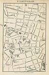
From: https://commons.wikimedia.org/wiki/File:Roscoe_L%26BR1839_p231_-_Map_of_Bi...
Links:
|
about 8 years ago. | 11 control points. |
|
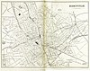
From: https://commons.wikimedia.org/wiki/File:EW1884_p.320_-_Birmingham_merged_-...
Links:
|
about 8 years ago. | 17 control points. |

|
From: https://commons.wikimedia.org/wiki/File:Birmingham_%26_Bordesley_RJD_7.jpg
Links:
|
about 8 years ago. | 15 control points. |

|
From: https://commons.wikimedia.org/wiki/File:Gough_Map_Birmingham.jpg
Links:
|
about 8 years ago. | 5 control points. |

|
From: https://commons.wikimedia.org/wiki/File:Gough_Kaart_hoge_resolutie.jpg
Links:
|
about 8 years ago. | 27 control points. |

|
From: https://commons.wikimedia.org/wiki/File:KAARTEN_SGD_-_Aanleg_van_scheepvaa...
Links:
|
about 8 years ago. | 33 control points. |

|
From: https://commons.wikimedia.org/wiki/File:Descriptive_map_of_London_poverty,...
Links:
|
about 8 years ago. | 9 control points. |
Displaying Map 4621 - 4630 of 4757 in total. per page.