From: https://commons.wikimedia.org/wiki/File:12_Plane-Table_Sheets_Covering_Who... Uploaded by Ndalyrose. (In 1 mosaic) Last modified about 6 years ago. 7 control points.
Links:
|
|
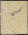
File:12 Plane-Table Sheets Covering Whole Length of Original Frontier from L. Tanganyika to Uganda & Extension South to Kigoma. - War Office ledger. WOOS-4-1-10.jpg
From: https://commons.wikimedia.org/wiki/File:12_Plane-Table_Sheets_Covering_Who... Uploaded by Ndalyrose. (In 1 mosaic) Last modified about 6 years ago. 7 control points. Links: |
 WMS Capabilities URL
 Tiles base URL
 Download points as CSV