From: https://commons.wikimedia.org/wiki/File:Admiralty_Chart_No_1814_Ecuador_Co... Uploaded by Kognos. Last modified almost 4 years ago. 13 control points.
Links:
|
|
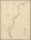
File:Admiralty Chart No 1814 Ecuador Coast South America West Coast Sheet XVIII Ecuador Ayangui Pt. to Verde Pt. Surveyed by Captn. Henry Kellett R.N. 1836, Published 1847.jpg
From: https://commons.wikimedia.org/wiki/File:Admiralty_Chart_No_1814_Ecuador_Co... Uploaded by Kognos. Last modified almost 4 years ago. 13 control points. Links: |
 WMS Capabilities URL
 Tiles base URL
 Download points as CSV