
From: https://commons.wikimedia.org/wiki/File:Frankreich_im_XIV_und_XV_Jahrhunde... Uploaded by Alphathon. Last modified 5 months ago. 478 control points.
Links:
|
|
File:Frankreich im XIV und XV Jahrhundert - Professor G. Droysens Allgemeiner historischer Handatlas 1886 134037951, cropped.jpg
From: https://commons.wikimedia.org/wiki/File:Frankreich_im_XIV_und_XV_Jahrhunde... Uploaded by Alphathon. Last modified 5 months ago. 478 control points. Links: |
 WMS Capabilities URL
 Tiles base URL
 Download points as CSV
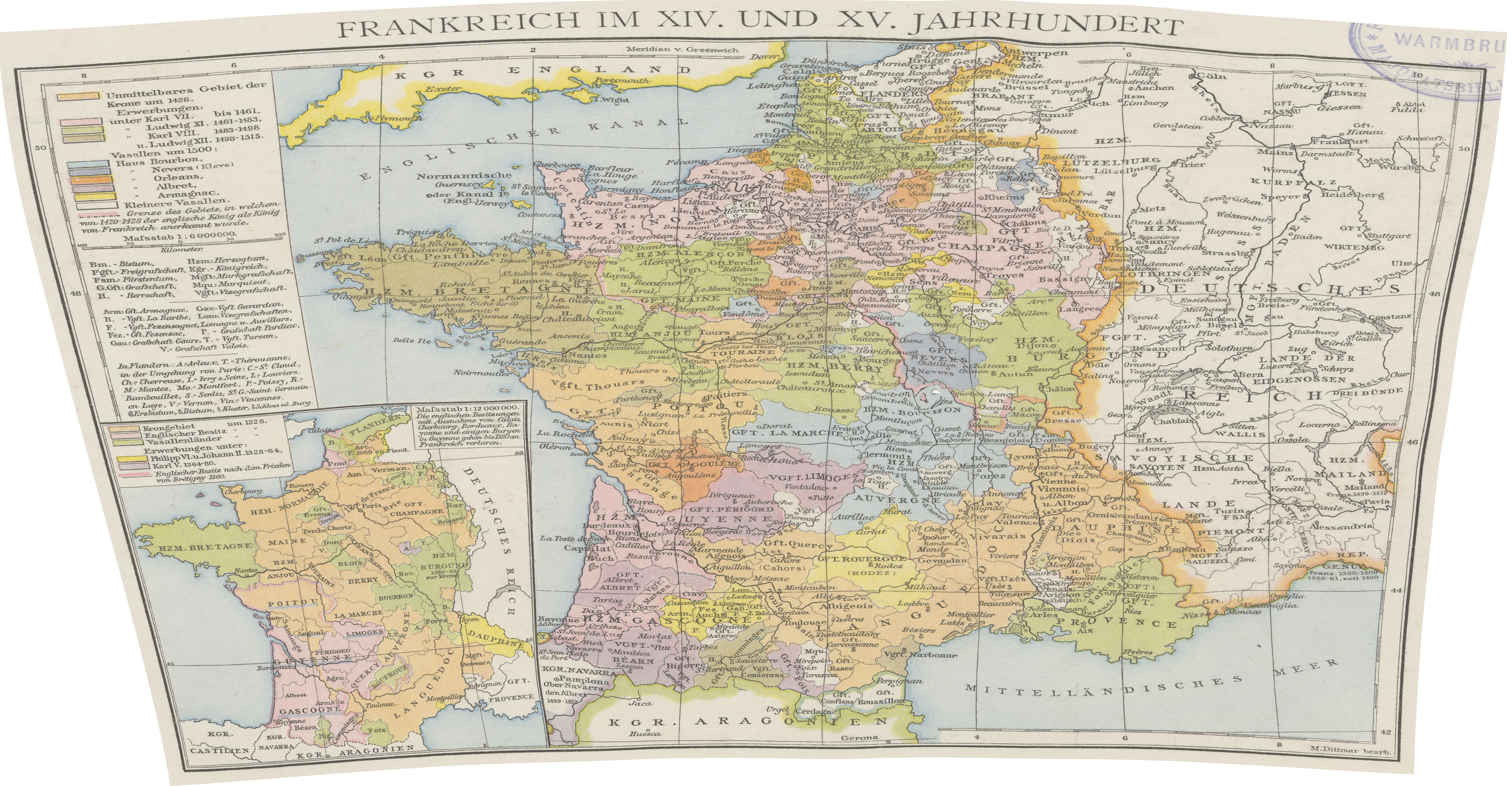