From: https://commons.wikimedia.org/wiki/File:NYC_Manhattan_Topo_Land_Use_1865_W... Uploaded by DutchTreat. Last modified over 4 years ago. 9 control points.
Links:
|
|
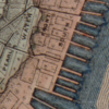
File:NYC Manhattan Topo Land Use 1865 Water Front South Streets LCN g3804n.ct002003.png
From: https://commons.wikimedia.org/wiki/File:NYC_Manhattan_Topo_Land_Use_1865_W... Uploaded by DutchTreat. Last modified over 4 years ago. 9 control points. Links: |
Title
File:NYC Manhattan Topo Land Use 1865 Water Front South Streets (LCN g3804n.ct002003).png
Description
From: https://commons.wikimedia.org/wiki/File:NYC_Manhattan_Topo_Land_Use_1865_Water_Front_South_Streets_(LCN_g3804n.ct002003).png
is_map
Source/ Bibliographic Ref URL
https://commons.wikimedia.org/wiki/File:NYC_Manhattan_Topo_Land_Use_1865_Water_Front_South_Streets_(LCN_g3804n.ct002003).png
Publisher
Author(s)
Scale
Published Date
Reprint Date
 WMS Capabilities URL
 Tiles base URL
 Download points as CSV