From: https://commons.wikimedia.org/wiki/File:12_Plane-Table_Sheets_Covering_Who... Uploaded by Ndalyrose. (In 1 mosaic) Last modified almost 5 years ago. Unrectified.
Links:
|
|
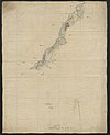
File:12 Plane-Table Sheets Covering Whole Length of Original Frontier from L. Tanganyika to Uganda & Extension South to Kigoma. - War Office ledger. WOOS-4-1-8.jpg
From: https://commons.wikimedia.org/wiki/File:12_Plane-Table_Sheets_Covering_Who... Uploaded by Ndalyrose. (In 1 mosaic) Last modified almost 5 years ago. Unrectified. Links: |
Title
File:12 Plane-Table Sheets Covering Whole Length of Original Frontier from L. Tanganyika to Uganda & Extension South to Kigoma. - War Office ledger. (WOOS-4-1-8).jpg
Description
From: https://commons.wikimedia.org/wiki/File:12_Plane-Table_Sheets_Covering_Whole_Length_of_Original_Frontier_from_L._Tanganyika_to_Uganda_%26_Extension_South_to_Kigoma._-_War_Office_ledger._(WOOS-4-1-8).jpg
is_map
Source/ Bibliographic Ref URL
https://commons.wikimedia.org/wiki/File:12_Plane-Table_Sheets_Covering_Whole_Length_of_Original_Frontier_from_L._Tanganyika_to_Uganda_%26_Extension_South_to_Kigoma._-_War_Office_ledger._(WOOS-4-1-8).jpg
Publisher
Author(s)
Scale
Published Date
Reprint Date
 WMS Capabilities URL
 Tiles base URL
 Download points as CSV