From: https://commons.wikimedia.org/wiki/File:White%27s_1873_map_of_WV_counties_... Uploaded by Scewing. Last modified over 3 years ago. 4 control points.
Links:
|
|
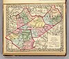
File:White's 1873 map of WV counties of Clay, Webster, Nicholas, Fayette.jpg
From: https://commons.wikimedia.org/wiki/File:White%27s_1873_map_of_WV_counties_... Uploaded by Scewing. Last modified over 3 years ago. 4 control points. Links: |
Title
File:White's 1873 map of WV counties of Clay, Webster, Nicholas, Fayette.jpg
Description
From: https://commons.wikimedia.org/wiki/File:White%27s_1873_map_of_WV_counties_of_Clay,_Webster,_Nicholas,_Fayette.jpg
is_map
Source/ Bibliographic Ref URL
https://commons.wikimedia.org/wiki/File:White%27s_1873_map_of_WV_counties_of_Clay,_Webster,_Nicholas,_Fayette.jpg
Publisher
Author(s)
Scale
Published Date
Reprint Date
 WMS Capabilities URL
 Tiles base URL
 Download points as CSV