From: https://commons.wikimedia.org/wiki/File:Plan_of_the_Country_near_Likoni_an... Uploaded by Ndalyrose. (In 1 mosaic) Last modified over 10 years ago. 5 control points.
Links:
|
|
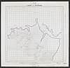
File:Plan of the Country near Likoni and Mtongwe. Created WOMAT-AFR-BEA-241-2.jpg
From: https://commons.wikimedia.org/wiki/File:Plan_of_the_Country_near_Likoni_an... Uploaded by Ndalyrose. (In 1 mosaic) Last modified over 10 years ago. 5 control points. Links: |
Title
File:Plan of the Country near Likoni and Mtongwe. Created (WOMAT-AFR-BEA-241-2).jpg
Description
From: https://commons.wikimedia.org/wiki/File:Plan_of_the_Country_near_Likoni_and_Mtongwe._Created_(WOMAT-AFR-BEA-241-2).jpg
is_map
Source/ Bibliographic Ref URL
https://commons.wikimedia.org/wiki/File:Plan_of_the_Country_near_Likoni_and_Mtongwe._Created_(WOMAT-AFR-BEA-241-2).jpg
Publisher
Author(s)
Scale
Published Date
Reprint Date
 WMS Capabilities URL
 Tiles base URL
 Download points as CSV