Browse Maps
| Map | Title  |
Last modified | Status |
|---|---|---|---|
|
From: https://commons.wikimedia.org/wiki/File:1801_-_20_-_29A_1806_Districts_int...
Links:
|
over 1 year ago. | 7 control points. |
|
From: https://commons.wikimedia.org/wiki/File:1801_-_20_-_30_Territories_of_Myso...
Links:
|
about 3 years ago. | 4 control points. |
|
From: https://commons.wikimedia.org/wiki/File:1801_-_20_-_30A_Territories_of_Mys...
Links:
|
over 1 year ago. | 9 control points. |
|
From: https://commons.wikimedia.org/wiki/File:1801_-_20_-_42_1811_Survey_of_Part...
Links:
|
almost 4 years ago. | 6 control points. |
|
From: https://commons.wikimedia.org/wiki/File:1801_-_20_-_52_Operations_of_Trigo...
Links:
|
over 1 year ago. | 6 control points. |

|
From: https://commons.wikimedia.org/wiki/File:1801_-_20_-_55_Trigonometrical_Ope...
Links:
|
over 1 year ago. | 12 control points. |

|
From: https://commons.wikimedia.org/wiki/File:1801_-_20_-_61_Fort_and_Petta_of_M...
Links:
|
over 1 year ago. | 3 control points. |
|
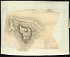
From: https://commons.wikimedia.org/wiki/File:1801_-_20_-_62E_Sketch_of_Gopal_Sa...
Links:
|
almost 3 years ago. | 3 control points. |
|
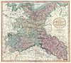
From: https://commons.wikimedia.org/wiki/File:1801_Cary_Map_of_Upper_Saxony,_Ger...
Links:
|
over 7 years ago. | 3 control points. |

|
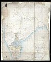
From: https://commons.wikimedia.org/wiki/File:1801_Cary_Map_of_the_East_Indies_a...
Links:
|
over 8 years ago. | 3 control points. |
Displaying Map 181 - 190 of 6315 in total. per page.