Browse Maps
| Map | Title  |
Last modified | Status |
|---|---|---|---|
|
From: https://commons.wikimedia.org/wiki/File:Gent_1572_B%26H_tcl.sc.edu.jpg
Links:
|
over 2 years ago. | 10 control points. |

|
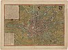
From: https://commons.wikimedia.org/wiki/File:Gent,_1892,_by_J.B._Delahoese,_J._...
Links:
|
about 9 years ago. | 9 control points. |

|
From: https://commons.wikimedia.org/wiki/File:Geografisk_karta_%C3%B6fver_Piikki...
Links:
|
about 9 years ago. | 7 control points. |

|
From: https://commons.wikimedia.org/wiki/File:Geographisk_charta_%C3%B6fver_Hels...
Links:
|
almost 7 years ago. | 4 control points. |
|
From: https://commons.wikimedia.org/wiki/File:Geological_map_Laramie.jpg
Links:
|
about 2 years ago. | 5 control points. |

|
From: https://commons.wikimedia.org/wiki/File:Geological_map_of_India_1911.jpg
Links:
|
over 7 years ago. | 5 control points. |

|
From: https://commons.wikimedia.org/wiki/File:Geologische_Karte_des_Untersberges...
Links:
|
over 8 years ago. | 10 control points. |

|
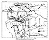
From: https://commons.wikimedia.org/wiki/File:Geology_Chatham_Sketch_Map_Page018...
Links:
|
over 3 years ago. | 5 control points. |

|
From: https://commons.wikimedia.org/wiki/File:Geology_Elgundel_Circar.jpg
Links:
|
about 4 years ago. | 3 control points. |

|
From: https://commons.wikimedia.org/wiki/File:Geology_Gazetteer_map_1897.jpg
Links:
|
over 7 years ago. | 3 control points. |
Displaying Map 3441 - 3450 of 6312 in total. per page.