Browse Maps
| Map | Title  |
Last modified | Status |
|---|---|---|---|
|
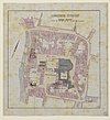
File:HUA-206827-Plattegrond van de voormalige burcht Trecht het Domplein en omgeving te Utrecht .jpg
From: https://commons.wikimedia.org/wiki/File:HUA-206827-Plattegrond_van_de_voor...
Links:
|
over 3 years ago. | 4 control points. |

|
From: https://commons.wikimedia.org/wiki/File:HUA-206870-Plattegrond_van_de_Krom...
Links:
|
over 3 years ago. | 4 control points. |
|
From: https://commons.wikimedia.org/wiki/File:HUA-210073-Kaart_van_een_deel_van_...
Links:
|
over 3 years ago. | 5 control points. |

|
From: https://commons.wikimedia.org/wiki/File:HUA-210074-Plattegrond_van_de_stad...
Links:
|
over 3 years ago. | 4 control points. |

|
From: https://commons.wikimedia.org/wiki/File:HUA-210075-Plattegrond_van_de_stad...
Links:
|
over 3 years ago. | 4 control points. |

|
From: https://commons.wikimedia.org/wiki/File:HUA-210076-Plattegrond_van_de_stad...
Links:
|
over 3 years ago. | 4 control points. |

|
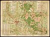
From: https://commons.wikimedia.org/wiki/File:HUA-210084-Kaart_van_de_provincie_...
Links:
|
over 3 years ago. | 4 control points. |

|
From: https://commons.wikimedia.org/wiki/File:HUA-210085-Plattegrond_van_de_stad...
Links:
|
over 3 years ago. | 3 control points. |
|
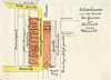
From: https://commons.wikimedia.org/wiki/File:HUA-212051-Plattegrond_van_het_ger...
Links:
|
over 3 years ago. | 3 control points. |

|
From: https://commons.wikimedia.org/wiki/File:HUA-212070-Plattegrond_van_het_ter...
Links:
|
over 3 years ago. | 4 control points. |
Displaying Map 3541 - 3550 of 6312 in total. per page.