Browse Maps
| Map | Title | Last modified  |
Status |
|---|---|---|---|

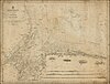
|
From: https://commons.wikimedia.org/wiki/File:Admiralty_Chart_No_2348_Sitka_or_N...
Links:
|
over 1 year ago. | 1 control point. |

|
From: https://commons.wikimedia.org/wiki/File:Admiralty_Chart_No_449_Mediterrane...
Links:
|
over 1 year ago. | 11 control points. |

|
From: https://commons.wikimedia.org/wiki/File:Admiralty_Chart_No_2137_China_Sea_...
Links:
|
over 1 year ago. | 10 control points. |

|
From: https://commons.wikimedia.org/wiki/File:Admiralty_Chart_No_2159_Firth_of_C...
Links:
|
over 1 year ago. | 12 control points. |

|
From: https://commons.wikimedia.org/wiki/File:Admiralty_Chart_No_2736_India._Wes...
Links:
|
over 1 year ago. | 6 control points. |

|
From: https://commons.wikimedia.org/wiki/File:Admiralty_Chart_No_1965_Kua_Lakh_t...
Links:
|
over 1 year ago. | 8 control points. |

|
From: https://commons.wikimedia.org/wiki/File:Admiralty_Chart_No_1613_Prawle_Poi...
Links:
|
over 1 year ago. | 7 control points. |

|
From: https://commons.wikimedia.org/wiki/File:Admiralty_Chart_No_2412_Amoy_to_Na...
Links:
|
over 1 year ago. | 13 control points. |
|
From: https://commons.wikimedia.org/wiki/File:Admiralty_Chart_No_1455_England_Ea...
Links:
|
over 1 year ago. | 4 control points. |

|
From: https://commons.wikimedia.org/wiki/File:Admiralty_Chart_No_2666_St_Johns_N...
Links:
|
over 1 year ago. | 9 control points. |
Displaying Map 4361 - 4370 of 5914 in total. per page.