Browse Maps
| Map | Title | Last modified | Status  |
|---|---|---|---|
|
From: https://commons.wikimedia.org/wiki/File:KAARTEN_SGD_-_Bevordering_van_den_...
Links:
|
about 8 years ago. | 12 control points. |

|
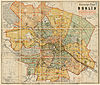
From: https://commons.wikimedia.org/wiki/File:Berlin_Innere_Stadt_Meyers_gro%C3%...
Links:
|
about 8 years ago. | 4 control points. |

|
From: https://commons.wikimedia.org/wiki/File:South_China_Sea_and_the_Gulf_of_To...
Links:
|
about 8 years ago. | 5 control points. |
|
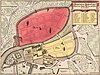
From: https://commons.wikimedia.org/wiki/File:Memhardt_Grundri%C3%9F_der_Beyden_...
Links:
|
about 8 years ago. | 9 control points. |
|
From: https://commons.wikimedia.org/wiki/File:Neuester_Plan_von_Berlin_mit_den_K...
Links:
|
about 8 years ago. | 5 control points. |

|
From: https://commons.wikimedia.org/wiki/File:Sotzmann_Berlin_1798.jpg
Links:
|
about 8 years ago. | 5 control points. |

|
From: https://commons.wikimedia.org/wiki/File:Helsingin_matkailijakartta_1940.jp...
Links:
|
almost 6 years ago. | 3 control points. |

|
From: https://commons.wikimedia.org/wiki/File:Sotzmann_Grundriss_der_K%C3%B6nigl...
Links:
|
about 8 years ago. | 5 control points. |

|
From: https://commons.wikimedia.org/wiki/File:Operational_Navigation_Chart_A-1,_...
Links:
|
about 8 years ago. | Unrectified. |

|
From: https://commons.wikimedia.org/wiki/File:Oesfeld_Grundriss_der_k%C3%B6nigl....
Links:
|
about 8 years ago. | 4 control points. |
Displaying Map 5151 - 5160 of 5918 in total. per page.