Browse Maps
| Map | Title | Last modified  |
Status |
|---|---|---|---|
|
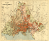
From: https://commons.wikimedia.org/wiki/File:Oslo_kommune_byarkivet,_oversiktsk...
Links:
|
7 days ago. | 29 control points. |

|
From: https://commons.wikimedia.org/wiki/File:Environs_de_Paris_-_2337_I_BCZK_-_...
Links:
|
7 days ago. | 4 control points. |
|
Links:
|
7 days ago. | 1 control point. |

|
From: https://commons.wikimedia.org/wiki/File:U.K._War_Office_District_Map_G_Spi...
Links:
|
7 days ago. | 5 control points. |

|
From: https://commons.wikimedia.org/wiki/File:Map_by_the_US_Army_Map_Service_-_S...
Links:
|
8 days ago. | 13 control points. |

|
From: https://commons.wikimedia.org/wiki/File:Map_of_Baie_Recherche_and_Van_Keul...
Links:
|
8 days ago. | 11 control points. |

|
From: https://commons.wikimedia.org/wiki/File:Carta_Esferica_de_las_Costas_Y_Gol...
Links:
|
8 days ago. | 9 control points. |

|
From: https://commons.wikimedia.org/wiki/File:Map_by_the_US_Army_Map_Service_-_S...
Links:
|
9 days ago. | 13 control points. |

|
From: https://commons.wikimedia.org/wiki/File:Kaart_Figuratief_Delft_Eerste_staa...
Links:
|
9 days ago. | 7 control points. |

|
From: https://commons.wikimedia.org/wiki/File:Chart_of_the_south_parts_of_Barent...
Links:
|
9 days ago. | 10 control points. |
Displaying Map 11 - 20 of 8841 in total. per page.