Browse Maps
| Map | Title | Last modified  |
Status |
|---|---|---|---|

|
From: https://commons.wikimedia.org/wiki/File:Tiruchirappalli_city_locator.png
Links:
|
5 months ago. | 6 control points. |
|
From: https://commons.wikimedia.org/wiki/File:The_General_Planting_Scheme_of_Nic...
Links:
|
5 months ago. | Unrectified. |

|
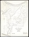
From: https://commons.wikimedia.org/wiki/File:Admiralty_Chart_No_107_Cromer_Knol...
Links:
|
5 months ago. | 9 control points. |

|
From: https://commons.wikimedia.org/wiki/File:Kl%C3%B6denplan-Berlin-K%C3%B6lln-...
Links:
|
5 months ago. | Unrectified. |

|
From: https://commons.wikimedia.org/wiki/File:Ethiopia_Hydrogeology3.png
Links:
|
6 months ago. | 5 control points. |
|
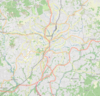
From: https://commons.wikimedia.org/wiki/File:Yaound%C3%A9_Openstreetmap.png
Links:
|
6 months ago. | Unrectified. |

|
From: https://commons.wikimedia.org/wiki/File:1940_Census_Enumeration_District_M...
Links:
|
6 months ago. | 5 control points. |

|
From: https://commons.wikimedia.org/wiki/File:West_Galicia.png
Links:
|
6 months ago. | 6 control points. |

|
From: https://commons.wikimedia.org/wiki/File:1777_Plan-Luetzow-Charlottenburg-W...
Links:
|
6 months ago. | 3 control points. |

|
Links:
|
6 months ago. | 4 control points. |
Displaying Map 381 - 390 of 6226 in total. per page.