Browse Maps
| Map | Title | Last modified  |
Status |
|---|---|---|---|

|
From: https://commons.wikimedia.org/wiki/File:Tupi.jpg
Links:
|
about 5 years ago. | 4 control points. |

|
From: https://commons.wikimedia.org/wiki/File:VentosBrasil.png
Links:
|
about 5 years ago. | 9 control points. |

|
From: https://commons.wikimedia.org/wiki/File:Guadaloupe_Pollacchi.jpg
Links:
|
about 5 years ago. | 10 control points. |

|
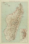
From: https://commons.wikimedia.org/wiki/File:Madagascar_Political_Pollacchi.jpg
Links:
|
about 5 years ago. | 4 control points. |

|
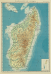
From: https://commons.wikimedia.org/wiki/File:Madagascar_Physical_Pollacchi.png
Links:
|
about 5 years ago. | 4 control points. |

|
From: https://commons.wikimedia.org/wiki/File:Indochina_Pollacchi.png
Links:
|
about 5 years ago. | 4 control points. |

|
From: https://commons.wikimedia.org/wiki/File:Het_eiland_Deshima-Rijksmuseum_NG-...
Links:
|
about 5 years ago. | 8 control points. |

|
From: https://commons.wikimedia.org/wiki/File:Hopi_reservation_partion_%26_Navaj...
Links:
|
about 5 years ago. | 13 control points. |

|
From: https://commons.wikimedia.org/wiki/File:Timb%C3%B3_and_Tay%C3%AD.png
Links:
|
about 5 years ago. | 7 control points. |

|
From: https://commons.wikimedia.org/wiki/File:ISIS_Grey_Territory_Change_2014-20...
Links:
|
about 5 years ago. | 4 control points. |
Displaying Map 5061 - 5070 of 6914 in total. per page.