Browse Maps
| Map | Title | Last modified  |
Status |
|---|---|---|---|

|
From: https://commons.wikimedia.org/wiki/File:Plane_Table_Sheets_No_1,_to_6._-_W... (In 1 mosaic)
Links:
|
over 8 years ago. | Unrectified. |

|
From: https://commons.wikimedia.org/wiki/File:Panoramic_View_of_the_Ilembi_Trian... (In 1 mosaic)
Links:
|
over 8 years ago. | Unrectified. |
|
From: https://commons.wikimedia.org/wiki/File:Note_to_be_attached_to_Plan_No._54... (In 1 mosaic)
Links:
|
over 8 years ago. | Unrectified. |

|
From: https://commons.wikimedia.org/wiki/File:Rough_Sketch_of_the_Route_of_The_T... (In 1 mosaic)
Links:
|
over 8 years ago. | Unrectified. |

|
From: https://commons.wikimedia.org/wiki/File:Northern_Frontier._Archers_Post_-_... (In 1 mosaic)
Links:
|
over 8 years ago. | Unrectified. |
|
From: https://commons.wikimedia.org/wiki/File:Mt._Lorienatom._Northern_Turkana.S... (In 1 mosaic)
Links:
|
over 8 years ago. | Unrectified. |

|
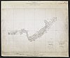
From: https://commons.wikimedia.org/wiki/File:Maps_of_the_Area_from_the_Mouth_of... (In 1 mosaic)
Links:
|
over 8 years ago. | Unrectified. |

|
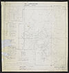
From: https://commons.wikimedia.org/wiki/File:Map_of_Nandi_District_-_British_Ea... (In 1 mosaic)
Links:
|
over 8 years ago. | Unrectified. |
|
From: https://commons.wikimedia.org/wiki/File:Map_Attached_to_Protocol_Describin... (In 1 mosaic)
Links:
|
over 8 years ago. | Unrectified. |
|
From: https://commons.wikimedia.org/wiki/File:Four_Sheets_of_Rapid_Plane_Table_S... (In 1 mosaic)
Links:
|
over 8 years ago. | Unrectified. |
Displaying Map 5301 - 5310 of 6228 in total. per page.