Browse Maps
| Map | Title | Last modified  |
Status |
|---|---|---|---|

|
From: https://commons.wikimedia.org/wiki/File:29.9.13._Extract_from_Report_on_No... (In 1 mosaic)
Links:
|
over 8 years ago. | Unrectified. |
|
From: https://commons.wikimedia.org/wiki/File:29.9.13._Extract_from_Report_on_No... (In 1 mosaic)
Links:
|
over 8 years ago. | Unrectified. |

|
From: https://commons.wikimedia.org/wiki/File:12_Plane-Table_Sheets_Covering_Who... (In 1 mosaic)
Links:
|
over 8 years ago. | Unrectified. |

|
From: https://commons.wikimedia.org/wiki/File:Africa-Uganda._WOOS-13-4-6-1.jpg (In 1 mosaic)
Links:
|
over 8 years ago. | Unrectified. |
|
From: https://commons.wikimedia.org/wiki/File:12_Plane-Table_Sheets_Covering_Who... (In 1 mosaic)
Links:
|
over 8 years ago. | Unrectified. |

|
From: https://commons.wikimedia.org/wiki/File:12_Plane-Table_Sheets_Covering_Who... (In 1 mosaic)
Links:
|
over 8 years ago. | Unrectified. |
|
From: https://commons.wikimedia.org/wiki/File:12_Plane-Table_Sheets_Covering_Who... (In 1 mosaic)
Links:
|
over 8 years ago. | Unrectified. |

|
From: https://commons.wikimedia.org/wiki/File:12_Plane-Table_Sheets_Covering_Who... (In 1 mosaic)
Links:
|
over 8 years ago. | Unrectified. |

|
From: https://commons.wikimedia.org/wiki/File:Senate_Atlas,_1870%E2%80%931907._S...
Links:
|
over 8 years ago. | 5 control points. |
|
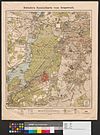
From: https://commons.wikimedia.org/wiki/File:Straube_Spezialkarte_vom_Grunewald...
Links:
|
over 8 years ago. | 11 control points. |
Displaying Map 5841 - 5850 of 6226 in total. per page.