Browse Maps
| Map | Title | Last modified  |
Status |
|---|---|---|---|
|
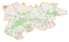
From: https://commons.wikimedia.org/wiki/File:Powiat_zgierski_location_map.png
Links:
|
7 months ago. | 4 control points. |

|
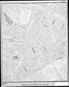
From: https://commons.wikimedia.org/wiki/File:1918-1939_circa_Open_GeoData_Plan_...
Links:
|
7 months ago. | 3 control points. |
|
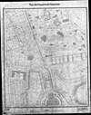
From: https://commons.wikimedia.org/wiki/File:1918-1939_circa_Open_GeoData_Plan_...
Links:
|
7 months ago. | 3 control points. |

|
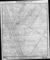
From: https://commons.wikimedia.org/wiki/File:1918-1939_circa_Open_GeoData_Plan_...
Links:
|
7 months ago. | 3 control points. |
|
From: https://commons.wikimedia.org/wiki/File:1918-1939_circa_Open_GeoData_Plan_...
Links:
|
7 months ago. | 3 control points. |

|
From: https://commons.wikimedia.org/wiki/File:1918-1939_circa_Open_GeoData_Plan_...
Links:
|
7 months ago. | 3 control points. |

|
From: https://commons.wikimedia.org/wiki/File:1918-1939_circa_Open_GeoData_Plan_...
Links:
|
7 months ago. | 5 control points. |

|
From: https://commons.wikimedia.org/wiki/File:1918-1939_circa_Open_GeoData_Plan_...
Links:
|
7 months ago. | Unrectified. |

|
From: https://commons.wikimedia.org/wiki/File:1918-1939_circa_Open_GeoData_Plan_...
Links:
|
7 months ago. | 3 control points. |
|
From: https://commons.wikimedia.org/wiki/File:1918-1939_circa_Open_GeoData_Plan_...
Links:
|
7 months ago. | 4 control points. |
Displaying Map 731 - 740 of 6226 in total. per page.