Last Rectified Maps
| Map | Title | Last modified | Status |
|---|---|---|---|

|
From: https://commons.wikimedia.org/wiki/File:%C3%8Ele_d%27Ouessant_-_D._Laisn%C...
Links:
|
about 22 hours ago. | 25 control points. |

|
From: https://commons.wikimedia.org/wiki/File:%C3%8Ele_d%27Ouessant_-_btv1b53153...
Links:
|
1 day ago. | 36 control points. |

|
From: https://commons.wikimedia.org/wiki/File:Admiralty_Chart_No_3420_Bougainvil...
Links:
|
3 days ago. | 9 control points. |
Recent Mosaics
| Mosaic | Title | Number of Maps | Percentage Complete |
|---|---|---|---|

|
Category:War Office Archive – British East Africa
Compiled by tim. Last modified about 1 month ago. Depicts : Links: |
570 maps |
9% (51 maps) |

|
Category:RPA Historic Wetlands
This is part of a project undertaken by Regional Plan Association (www.rpa.org) and funded by the Doris Duke Foundation, with additional support from the Leon Lowenstein Foundation. In partnership with OpenHistoricalMap, TeachOSM, and many others, this project will map out the historic wetlands of the New York metropolitan area, as part of a study on climate adaptation and habitat restoration. If you have questions, you can contact Sanjay Seth (sanjay@rpa.org) Compiled by sanjayseth. Last modified about 1 month ago. Depicts : Links: |
173 maps |
11% (19 maps) |
|
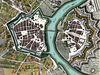
Dresden
Testing Compiled by wikihack. Last modified about 1 month ago. Depicts : 1750 Links: |
1 map |
100% (1 map) |