file missing
Browse Maps
| Map | Title | Last modified  |
Status |
|---|---|---|---|

|
From: https://commons.wikimedia.org/wiki/File:Li-chiang_NG47_7_2402741.jpg
Links:
|
1 day ago. | Unrectified. |

|
From: https://commons.wikimedia.org/wiki/File:Map_of_America_By_A._Arrowsmith_Hy...
Links:
|
2 days ago. | 49 control points. |

|
From: https://commons.wikimedia.org/wiki/File:Map_of_the_Territories_of_Upper_an...
Links:
|
3 days ago. | 106 control points. |

|
From: https://commons.wikimedia.org/wiki/File:A_New_Map_of_Mexico_and_adjacent_p...
Links:
|
3 days ago. | 120 control points. |
|
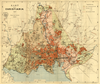
From: https://commons.wikimedia.org/wiki/File:Oslo_kommune_byarkivet,_oversiktsk...
Links:
|
3 days ago. | 29 control points. |

|
From: https://commons.wikimedia.org/wiki/File:Environs_de_Paris_-_2337_I_BCZK_-_...
Links:
|
3 days ago. | 4 control points. |
|
Links:
|
3 days ago. | 1 control point. |

|
From: https://commons.wikimedia.org/wiki/File:U.K._War_Office_District_Map_G_Spi...
Links:
|
4 days ago. | 5 control points. |

|
From: https://commons.wikimedia.org/wiki/File:Map_by_the_US_Army_Map_Service_-_S...
Links:
|
4 days ago. | 13 control points. |

|
From: https://commons.wikimedia.org/wiki/File:Map_of_Baie_Recherche_and_Van_Keul...
Links:
|
5 days ago. | 11 control points. |
Displaying Map 1 - 10 of 8836 in total. per page.