Browse Maps
| Map | Title  |
Last modified | Status |
|---|---|---|---|
|
From: https://commons.wikimedia.org/wiki/File:108_Sheet_Indian_Atlas_1840.jpg (In 1 mosaic)
Links:
|
30 days ago. | 4 control points. |
|
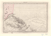
From: https://commons.wikimedia.org/wiki/File:109_Sheet_Indian_Atlas_1836.jpg (In 1 mosaic)
Links:
|
30 days ago. | 4 control points. |
|
From: https://commons.wikimedia.org/wiki/File:11_NE_Quarter_Sheet_Indian_Atlas_1... (In 1 mosaic)
Links:
|
about 3 years ago. | 3 control points. |
|
From: https://commons.wikimedia.org/wiki/File:11_NW_Quarter_Sheet_Indian_Atlas_1... (In 1 mosaic)
Links:
|
about 3 years ago. | 4 control points. |

|
From: https://commons.wikimedia.org/wiki/File:11_SE_Quarter_Sheet_Indian_Atlas_1... (In 1 mosaic)
Links:
|
about 3 years ago. | 3 control points. |
|
From: https://commons.wikimedia.org/wiki/File:11_SW_Quarter_Sheet_Indian_Atlas_1... (In 1 mosaic)
Links:
|
about 3 years ago. | 3 control points. |

|
From: https://commons.wikimedia.org/wiki/File:11-D-4_01.jpg
Links:
|
7 months ago. | 9 control points. |
|
From: https://commons.wikimedia.org/wiki/File:111_Sheet_Indian_Atlas_1866.jpg (In 1 mosaic)
Links:
|
about 3 years ago. | 3 control points. |
|
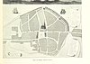
From: https://commons.wikimedia.org/wiki/File:111_of_%27Alt-Kiel_in_Wort_und_Bil...
Links:
|
over 5 years ago. | 7 control points. |

|
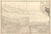
From: https://commons.wikimedia.org/wiki/File:112_Sheet_Indian_Atlas_1857.jpg (In 1 mosaic)
Links:
|
about 3 years ago. | 4 control points. |
Displaying Map 91 - 100 of 7755 in total. per page.