Browse Maps
| Map | Title | Last modified | Status  |
|---|---|---|---|

|
From: https://commons.wikimedia.org/wiki/File:Meilenblatt_B_57_Renthendorf.jpg
Links:
|
almost 3 years ago. | 4 control points. |
|
From: https://commons.wikimedia.org/wiki/File:Meilenblatt_B_56_Dreitzsch.jpg
Links:
|
almost 3 years ago. | 4 control points. |

|
From: https://commons.wikimedia.org/wiki/File:Meilenblatt_B_39_Rehmen.jpg
Links:
|
over 2 years ago. | 4 control points. |

|
From: https://commons.wikimedia.org/wiki/File:Meilenblatt_B_82_F%C3%B6rthen.jpg
Links:
|
over 2 years ago. | 4 control points. |

|
From: https://commons.wikimedia.org/wiki/File:1781_-_1800_-_04_1800_Route_of_Col...
Links:
|
about 3 years ago. | 6 control points. |

|
From: https://commons.wikimedia.org/wiki/File:Kingdoms_of_the_Levant_Map_830.png
Links:
|
over 2 years ago. | 28 control points. |
|
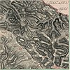
From: https://commons.wikimedia.org/wiki/File:PPN611881705_Gel%C3%A4nde_zwischen...
Links:
|
about 3 years ago. | 4 control points. |

|
From: https://commons.wikimedia.org/wiki/File:Torun_nach_dem_ersten_Ausbau_der_F...
Links:
|
over 2 years ago. | 3 control points. |

|
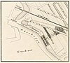
From: https://commons.wikimedia.org/wiki/File:HUA-200249-Plattegrond_van_de_stad...
Links:
|
over 2 years ago. | 4 control points. |

|
From: https://commons.wikimedia.org/wiki/File:La_Palma_lava_flows_into_the_sea_E...
Links:
|
over 2 years ago. | 10 control points. |
Displaying Map 4651 - 4660 of 5914 in total. per page.