Browse Maps
| Map | Title | Last modified  |
Status |
|---|---|---|---|

|
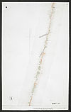
From: https://commons.wikimedia.org/wiki/File:Survey_of_Telegraph_Line_from_Meli... (In 1 mosaic)
Links:
|
about 8 years ago. | Unrectified. |
|
From: https://commons.wikimedia.org/wiki/File:Survey_of_Telegraph_Line_from_Meli... (In 1 mosaic)
Links:
|
about 8 years ago. | Unrectified. |

|
From: https://commons.wikimedia.org/wiki/File:Survey_of_Telegraph_Line_from_Meli... (In 1 mosaic)
Links:
|
about 8 years ago. | Unrectified. |

|
From: https://commons.wikimedia.org/wiki/File:Survey_of_Telegraph_Line_from_Meli... (In 1 mosaic)
Links:
|
about 8 years ago. | Unrectified. |

|
From: https://commons.wikimedia.org/wiki/File:Survey_of_Telegraph_Line_from_Frer... (In 1 mosaic)
Links:
|
about 8 years ago. | Unrectified. |

|
From: https://commons.wikimedia.org/wiki/File:Survey_of_Telegraph_Line_from_Frer... (In 1 mosaic)
Links:
|
about 8 years ago. | Unrectified. |

|
From: https://commons.wikimedia.org/wiki/File:Survey_of_British_Commission_for_t... (In 1 mosaic)
Links:
|
about 8 years ago. | Unrectified. |

|
From: https://commons.wikimedia.org/wiki/File:Uganda._Lower_Half_Sheet_86_UIII.X... (In 1 mosaic)
Links:
|
about 8 years ago. | Unrectified. |

|
From: https://commons.wikimedia.org/wiki/File:Sketch_to_Shew_Clearly_the_Contour... (In 1 mosaic)
Links:
|
about 8 years ago. | Unrectified. |

|
From: https://commons.wikimedia.org/wiki/File:Sketch_Map_Shewing_Proposed_Roads_... (In 1 mosaic)
Links:
|
about 8 years ago. | Unrectified. |
Displaying Map 4961 - 4970 of 5918 in total. per page.