Browse Maps
| Map | Title | Last modified  |
Status |
|---|---|---|---|

|
From: https://commons.wikimedia.org/wiki/File:Maribo_1898.jpg
Links:
|
5 days ago. | 9 control points. |

|
From: https://commons.wikimedia.org/wiki/File:Aakirkeby_1898.jpg
Links:
|
6 days ago. | 4 control points. |

|
From: https://commons.wikimedia.org/wiki/File:Svaneke_1898.jpg
Links:
|
6 days ago. | 6 control points. |

|
From: https://commons.wikimedia.org/wiki/File:Map_by_the_US_Army_Map_Service_-_A...
Links:
|
6 days ago. | Unrectified. |

|
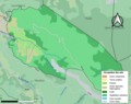
From: https://commons.wikimedia.org/wiki/File:64107-B%C3%A9horl%C3%A9guy-ZNIEFF2...
Links:
|
8 days ago. | Unrectified. |
|
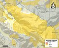
From: https://commons.wikimedia.org/wiki/File:64107-B%C3%A9horl%C3%A9guy-Sols.pn...
Links:
|
8 days ago. | Unrectified. |

|
From: https://commons.wikimedia.org/wiki/File:64107-B%C3%A9horl%C3%A9guy-ZNIEFF1...
Links:
|
8 days ago. | Unrectified. |
|
From: https://commons.wikimedia.org/wiki/File:64107-B%C3%A9horl%C3%A9guy-argile....
Links:
|
8 days ago. | Unrectified. |

|
From: https://commons.wikimedia.org/wiki/File:Map_commune_FR_insee_code_64107.pn...
Links:
|
8 days ago. | Unrectified. |

|
From: https://commons.wikimedia.org/wiki/File:Behorlegi_kokapena.png
Links:
|
8 days ago. | Unrectified. |
Displaying Map 1 - 10 of 7738 in total. per page.