Browse Maps
| Map | Title | Last modified  |
Status |
|---|---|---|---|

|
From: https://commons.wikimedia.org/wiki/File:Feijenoord_met_plan_van_bebouwing_...
Links:
|
3 months ago. | 4 control points. |

|
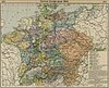
From: https://commons.wikimedia.org/wiki/File:Heiliges_R%C3%B6misches_Reich_1000...
Links:
|
3 months ago. | 1066 control points. |

|
From: https://commons.wikimedia.org/wiki/File:Atlas_Blaeu_Erfgoed_Leiden_en_Omst...
Links:
|
3 months ago. | 23 control points. |
|
From: https://commons.wikimedia.org/wiki/File:Central_europe_1648_sheperd.jpg
Links:
|
3 months ago. | 9 control points. |

|
From: https://commons.wikimedia.org/wiki/File:Braunschweig_1932-1945.png
Links:
|
3 months ago. | 26 control points. |

|
From: https://commons.wikimedia.org/wiki/File:Bahnh%C3%B6fe_Berlin_1890_Detail.j...
Links:
|
3 months ago. | 17 control points. |

|
From: https://commons.wikimedia.org/wiki/File:Sanborn_Fire_Insurance_Map_from_Do...
Links:
|
3 months ago. | 3 control points. |

|
From: https://commons.wikimedia.org/wiki/File:Sanborn_Fire_Insurance_Map_from_Gr...
Links:
|
3 months ago. | 3 control points. |

|
From: https://commons.wikimedia.org/wiki/File:Aberdeen_1893_1-125,000_-_PCL_Map_...
Links:
|
3 months ago. | 3 control points. |

|
From: https://commons.wikimedia.org/wiki/File:Gray%27s_Map_of_Suffolk,_Nansemond...
Links:
|
3 months ago. | 18 control points. |
Displaying Map 131 - 140 of 7271 in total. per page.