Browse Maps
| Map | Title | Last modified  |
Status |
|---|---|---|---|

|
From: https://commons.wikimedia.org/wiki/File:Northern_Tehran_1968,_Iranian_Oil_...
Links:
|
almost 2 years ago. | 4 control points. |

|
From: https://commons.wikimedia.org/wiki/File:Guide_map_of_city_of_Tehran,_1948....
Links:
|
almost 2 years ago. | 4 control points. |

|
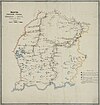
From: https://commons.wikimedia.org/wiki/File:Carte-touristique-Ouessant-1929.pn...
Links:
|
almost 2 years ago. | 5 control points. |

|
From: https://commons.wikimedia.org/wiki/File:0012_Planta_De_Castro_Marin.jpg
Links:
|
almost 2 years ago. | Unrectified. |

|
From: https://commons.wikimedia.org/wiki/File:1865_map_of_Tobolsk_Governorate_Ku...
Links:
|
almost 2 years ago. | 29 control points. |

|
From: https://commons.wikimedia.org/wiki/File:1865_map_of_Tobolsk_Governorate_Ya...
Links:
|
almost 2 years ago. | Unrectified. |
|
From: https://commons.wikimedia.org/wiki/File:1865_map_of_Tobolsk_Governorate_Is...
Links:
|
almost 2 years ago. | Unrectified. |

|
From: https://commons.wikimedia.org/wiki/File:1865_map_of_Tobolsk_Governorate_Tu...
Links:
|
almost 2 years ago. | Unrectified. |
|
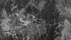
From: https://commons.wikimedia.org/wiki/File:Baikonur_Cosmodrome_imaged_by_a_KH...
Links:
|
almost 2 years ago. | 5 control points. |
|
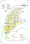
From: https://commons.wikimedia.org/wiki/File:Samara_in_1886.png
Links:
|
almost 2 years ago. | 5 control points. |
Displaying Map 2801 - 2810 of 8835 in total. per page.