Browse Maps
| Map | Title | Last modified  |
Status |
|---|---|---|---|

|
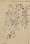
From: https://commons.wikimedia.org/wiki/File:Plan_of_Camp_Douglas,_1864-65.png
Links:
|
almost 10 years ago. | 4 control points. |

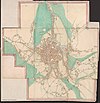
|
From: https://commons.wikimedia.org/wiki/File:1833_Chicago_map_by_Conley_%26_Ste...
Links:
|
almost 10 years ago. | Unrectified. |
|
From: https://commons.wikimedia.org/wiki/File:Ghent_by_Jacob_Van_Deventer,_BN_1....
Links:
|
almost 10 years ago. | 49 control points. |

|
From: https://commons.wikimedia.org/wiki/File:250px-We-mapblank.png
Links:
|
almost 10 years ago. | Unrectified. |

|
From: https://commons.wikimedia.org/wiki/File:Detailkart_over_Christiania_efter_...
Links:
|
almost 10 years ago. | 5 control points. |

|
From: https://commons.wikimedia.org/wiki/File:2016_shooting_of_Baton_Rouge_polic...
Links:
|
almost 10 years ago. | 6 control points. |

|
From: https://commons.wikimedia.org/wiki/File:Lake_Placid_1980_Winter_Olympics.j...
Links:
|
almost 10 years ago. | 5 control points. |

|
From: https://commons.wikimedia.org/wiki/File:Bahnstrecke_Mandalay%E2%80%93Lashi...
Links:
|
almost 10 years ago. | 4 control points. |

|
From: https://commons.wikimedia.org/wiki/File:Karte_Strassenbahn_Fl%C3%BCelen-Al...
Links:
|
almost 10 years ago. | 3 control points. |
|
From: https://commons.wikimedia.org/wiki/File:Ekserserplasskart;_Gardermomaaling...
Links:
|
almost 10 years ago. | Unrectified. |
Displaying Map 7691 - 7700 of 8762 in total. per page.