
Links:
570 maps (57 maps rectified 10%)
|

|
Category:War Office Archive – British East Africa
Links: 570 maps (57 maps rectified 10%) | |

| Map | Title | Last modified | Status |
|---|---|---|---|

|
From: https://commons.wikimedia.org/wiki/File:Plane-Table_Survey_of_Part_of_Usog... (In 1 mosaic)
Links:
|
almost 10 years ago. | Unrectified. |

|
From: https://commons.wikimedia.org/wiki/File:Plans_of_Proposed_Road_from_Nakase... (In 1 mosaic)
Links:
|
almost 10 years ago. | Unrectified. |

|
From: https://commons.wikimedia.org/wiki/File:Plans_of_Proposed_Road_from_Nakase... (In 1 mosaic)
Links:
|
almost 10 years ago. | Unrectified. |

|
From: https://commons.wikimedia.org/wiki/File:Plans_of_Proposed_Road_from_Nakase... (In 1 mosaic)
Links:
|
almost 10 years ago. | Unrectified. |

|
From: https://commons.wikimedia.org/wiki/File:Plans_of_Proposed_Road_from_Nakase... (In 1 mosaic)
Links:
|
almost 10 years ago. | Unrectified. |

|
From: https://commons.wikimedia.org/wiki/File:Plans_of_Proposed_Road_from_Nakase... (In 1 mosaic)
Links:
|
almost 10 years ago. | Unrectified. |

|
From: https://commons.wikimedia.org/wiki/File:Plans_of_Proposed_Road_from_Nakase... (In 1 mosaic)
Links:
|
almost 10 years ago. | Unrectified. |

|
From: https://commons.wikimedia.org/wiki/File:Portion_of_Survey_of_the_Nile_Prov... (In 1 mosaic)
Links:
|
almost 10 years ago. | Unrectified. |

|
From: https://commons.wikimedia.org/wiki/File:Portion_of_Survey_of_the_Nile_Prov... (In 1 mosaic)
Links:
|
almost 10 years ago. | Unrectified. |

|
From: https://commons.wikimedia.org/wiki/File:Positions_of_Water_Holes_-_War_Off... (In 1 mosaic)
Links:
|
almost 10 years ago. | Unrectified. |
|
From: https://commons.wikimedia.org/wiki/File:Positions_of_Water_Holes_-_War_Off... (In 1 mosaic)
Links:
|
almost 10 years ago. | Unrectified. |

|
From: https://commons.wikimedia.org/wiki/File:Positions_of_Water_Holes_-_War_Off... (In 1 mosaic)
Links:
|
almost 10 years ago. | Unrectified. |

|
From: https://commons.wikimedia.org/wiki/File:Positions_of_Water_Holes_-_War_Off... (In 1 mosaic)
Links:
|
almost 10 years ago. | Unrectified. |

|
From: https://commons.wikimedia.org/wiki/File:Preliminary_Drawings,_5_Sheets_MSS... (In 1 mosaic)
Links:
|
9 months ago. | Unrectified. |
|
From: https://commons.wikimedia.org/wiki/File:Preliminary_Drawings,_5_Sheets_MSS... (In 1 mosaic)
Links:
|
almost 10 years ago. | Unrectified. |
|
From: https://commons.wikimedia.org/wiki/File:Preliminary_Drawings,_5_Sheets_MSS... (In 1 mosaic)
Links:
|
almost 10 years ago. | Unrectified. |

|
From: https://commons.wikimedia.org/wiki/File:Preliminary_Drawings,_5_Sheets_MSS... (In 1 mosaic)
Links:
|
almost 10 years ago. | Unrectified. |

|
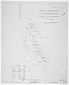
From: https://commons.wikimedia.org/wiki/File:Preliminary_Drawings,_5_Sheets_MSS... (In 1 mosaic)
Links:
|
almost 10 years ago. | Unrectified. |
|
From: https://commons.wikimedia.org/wiki/File:Prismatic_Compass_Sketch_of_New_Ro... (In 1 mosaic)
Links:
|
almost 10 years ago. | Unrectified. |

|
From: https://commons.wikimedia.org/wiki/File:Prismatic_Compass_Sketch_of_New_Ro... (In 1 mosaic)
Links:
|
almost 10 years ago. | Unrectified. |

|
From: https://commons.wikimedia.org/wiki/File:Prismatic_Compass_Sketch_of_the_Ni... (In 1 mosaic)
Links:
|
almost 10 years ago. | Unrectified. |

|
From: https://commons.wikimedia.org/wiki/File:Proposed_Deviation_from_Toro-Kampa... (In 1 mosaic)
Links:
|
almost 10 years ago. | Unrectified. |

|
From: https://commons.wikimedia.org/wiki/File:Proposed_Deviation_from_Toro-Kampa... (In 1 mosaic)
Links:
|
almost 10 years ago. | Unrectified. |
|
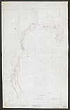
From: https://commons.wikimedia.org/wiki/File:Railway_Reconnaissance_Gilgil_-_Ke... (In 1 mosaic)
Links:
|
almost 10 years ago. | Unrectified. |
|
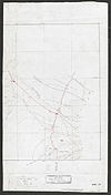
From: https://commons.wikimedia.org/wiki/File:Railway_Reconnaissance_Gilgil_-_Ke... (In 1 mosaic)
Links:
|
almost 10 years ago. | Unrectified. |

|
From: https://commons.wikimedia.org/wiki/File:Rapid_Road_Sketch_from_Entebbe_to_... (In 1 mosaic)
Links:
|
almost 10 years ago. | Unrectified. |

|
From: https://commons.wikimedia.org/wiki/File:Rapid_Road_Sketch_from_Entebbe_to_... (In 1 mosaic)
Links:
|
almost 10 years ago. | Unrectified. |

|
From: https://commons.wikimedia.org/wiki/File:Rapid_Road_Sketch_from_Entebbe_to_... (In 1 mosaic)
Links:
|
almost 10 years ago. | Unrectified. |

|
From: https://commons.wikimedia.org/wiki/File:Rapid_Road_Sketch_from_Entebbe_to_... (In 1 mosaic)
Links:
|
almost 10 years ago. | Unrectified. |

|
From: https://commons.wikimedia.org/wiki/File:Rapid_Road_Sketch_from_Entebbe_to_... (In 1 mosaic)
Links:
|
almost 10 years ago. | Unrectified. |