
Links:
570 maps (55 maps rectified 10%)
|

|
Category:War Office Archive – British East Africa
Links: 570 maps (55 maps rectified 10%) | |

| Map | Title | Last modified | Status |
|---|---|---|---|

|
From: https://commons.wikimedia.org/wiki/File:Survey_of_British_Commission_for_t... (In 1 mosaic)
Links:
|
over 9 years ago. | Unrectified. |

|
From: https://commons.wikimedia.org/wiki/File:Survey_of_Telegraph_Line_from_Frer... (In 1 mosaic)
Links:
|
over 9 years ago. | Unrectified. |

|
From: https://commons.wikimedia.org/wiki/File:Survey_of_Telegraph_Line_from_Frer... (In 1 mosaic)
Links:
|
over 9 years ago. | Unrectified. |

|
From: https://commons.wikimedia.org/wiki/File:Survey_of_Telegraph_Line_from_Frer... (In 1 mosaic)
Links:
|
over 9 years ago. | Unrectified. |
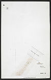
|
From: https://commons.wikimedia.org/wiki/File:Survey_of_Telegraph_Line_from_Frer... (In 1 mosaic)
Links:
|
over 9 years ago. | Unrectified. |

|
From: https://commons.wikimedia.org/wiki/File:Survey_of_Telegraph_Line_from_Frer... (In 1 mosaic)
Links:
|
over 9 years ago. | Unrectified. |

|
From: https://commons.wikimedia.org/wiki/File:Survey_of_Telegraph_Line_from_Frer... (In 1 mosaic)
Links:
|
over 9 years ago. | Unrectified. |

|
From: https://commons.wikimedia.org/wiki/File:Survey_of_Telegraph_Line_from_Frer... (In 1 mosaic)
Links:
|
over 9 years ago. | Unrectified. |

|
From: https://commons.wikimedia.org/wiki/File:Survey_of_Telegraph_Line_from_Frer... (In 1 mosaic)
Links:
|
over 9 years ago. | Unrectified. |

|
From: https://commons.wikimedia.org/wiki/File:Survey_of_Telegraph_Line_from_Frer... (In 1 mosaic)
Links:
|
over 9 years ago. | Unrectified. |

|
From: https://commons.wikimedia.org/wiki/File:Survey_of_Telegraph_Line_from_Frer... (In 1 mosaic)
Links:
|
over 9 years ago. | Unrectified. |

|
From: https://commons.wikimedia.org/wiki/File:Survey_of_Telegraph_Line_from_Frer... (In 1 mosaic)
Links:
|
over 9 years ago. | Unrectified. |

|
From: https://commons.wikimedia.org/wiki/File:Survey_of_Telegraph_Line_from_Frer... (In 1 mosaic)
Links:
|
over 9 years ago. | Unrectified. |
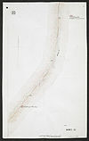
|
From: https://commons.wikimedia.org/wiki/File:Survey_of_Telegraph_Line_from_Frer... (In 1 mosaic)
Links:
|
over 9 years ago. | Unrectified. |
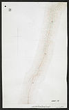
|
From: https://commons.wikimedia.org/wiki/File:Survey_of_Telegraph_Line_from_Frer... (In 1 mosaic)
Links:
|
over 9 years ago. | Unrectified. |

|
From: https://commons.wikimedia.org/wiki/File:Survey_of_Telegraph_Line_from_Frer... (In 1 mosaic)
Links:
|
over 9 years ago. | Unrectified. |

|
From: https://commons.wikimedia.org/wiki/File:Survey_of_Telegraph_Line_from_Frer... (In 1 mosaic)
Links:
|
over 9 years ago. | Unrectified. |

|
From: https://commons.wikimedia.org/wiki/File:Survey_of_Telegraph_Line_from_Frer... (In 1 mosaic)
Links:
|
over 9 years ago. | Unrectified. |
|
From: https://commons.wikimedia.org/wiki/File:Survey_of_Telegraph_Line_from_Frer... (In 1 mosaic)
Links:
|
over 9 years ago. | Unrectified. |

|
From: https://commons.wikimedia.org/wiki/File:Survey_of_Telegraph_Line_from_Frer... (In 1 mosaic)
Links:
|
over 9 years ago. | Unrectified. |

|
From: https://commons.wikimedia.org/wiki/File:Survey_of_Telegraph_Line_from_Frer... (In 1 mosaic)
Links:
|
over 9 years ago. | Unrectified. |

|
From: https://commons.wikimedia.org/wiki/File:Survey_of_Telegraph_Line_from_Frer... (In 1 mosaic)
Links:
|
over 9 years ago. | Unrectified. |

|
From: https://commons.wikimedia.org/wiki/File:Survey_of_Telegraph_Line_from_Frer... (In 1 mosaic)
Links:
|
over 9 years ago. | Unrectified. |
|
From: https://commons.wikimedia.org/wiki/File:Survey_of_Telegraph_Line_from_Frer... (In 1 mosaic)
Links:
|
over 9 years ago. | Unrectified. |
|
From: https://commons.wikimedia.org/wiki/File:Survey_of_Telegraph_Line_from_Frer... (In 1 mosaic)
Links:
|
over 9 years ago. | Unrectified. |

|
From: https://commons.wikimedia.org/wiki/File:Survey_of_Telegraph_Line_from_Frer... (In 1 mosaic)
Links:
|
over 9 years ago. | Unrectified. |

|
From: https://commons.wikimedia.org/wiki/File:Survey_of_Telegraph_Line_from_Meli... (In 1 mosaic)
Links:
|
over 9 years ago. | Unrectified. |

|
From: https://commons.wikimedia.org/wiki/File:Survey_of_Telegraph_Line_from_Meli... (In 1 mosaic)
Links:
|
over 9 years ago. | Unrectified. |
|
From: https://commons.wikimedia.org/wiki/File:Survey_of_Telegraph_Line_from_Meli... (In 1 mosaic)
Links:
|
over 9 years ago. | Unrectified. |

|
From: https://commons.wikimedia.org/wiki/File:Survey_of_Telegraph_Line_from_Meli... (In 1 mosaic)
Links:
|
over 9 years ago. | Unrectified. |