Browse Maps
| Map | Title  |
Last modified | Status |
|---|---|---|---|

|
From: https://commons.wikimedia.org/wiki/File:Sketch_Map_of_a_Portion_of_Jubalan... (In 1 mosaic)
Links:
|
about 8 years ago. | Unrectified. |

|
From: https://commons.wikimedia.org/wiki/File:Sketch_Plan_of_Kibumba._WOMAT-AFR-... (In 1 mosaic)
Links:
|
about 8 years ago. | Unrectified. |

|
From: https://commons.wikimedia.org/wiki/File:Sketch_map_of_the_Route_of_the_Tur... (In 1 mosaic)
Links:
|
about 8 years ago. | Unrectified. |

|
From: https://commons.wikimedia.org/wiki/File:Sketch_of_Country_between_Kitui_an... (In 1 mosaic)
Links:
|
about 8 years ago. | Unrectified. |

|
From: https://commons.wikimedia.org/wiki/File:Sketch_of_Country_traversed_Bayobo... (In 1 mosaic)
Links:
|
about 8 years ago. | Unrectified. |

|
From: https://commons.wikimedia.org/wiki/File:Sketch_of_Nandi_Station._WOMAT-AFR... (In 1 mosaic)
Links:
|
about 8 years ago. | Unrectified. |

|
From: https://commons.wikimedia.org/wiki/File:Sketch_of_Route_followed_to_Tarang... (In 1 mosaic)
Links:
|
about 8 years ago. | Unrectified. |

|
From: https://commons.wikimedia.org/wiki/File:Sketch_to_Illustrate_Report_on_the... (In 1 mosaic)
Links:
|
about 8 years ago. | Unrectified. |

|
From: https://commons.wikimedia.org/wiki/File:Sketch_to_Shew_Clearly_the_Contour... (In 1 mosaic)
Links:
|
about 8 years ago. | Unrectified. |
|
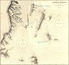
From: https://commons.wikimedia.org/wiki/File:Skiathos_Harbour_cropped_from_Admi...
Links:
|
over 1 year ago. | 12 control points. |
Displaying Map 5051 - 5060 of 5923 in total. per page.